Travel
An epic 38-mile hike to England’s northernmost point
By Daniel Stables,Features correspondent
 Getty Images
The latest stretch of the King Charles III England Coast Path takes hikers along the enchanting Northumberland coast via imperious castles, eerie mudflats and a tidal holy island.
“The whole of Britain looks like a witch riding on a pig.” So wrote Paul Theroux in The Kingdom by the Sea, his account of a journey around the coast of Britain in 1982. Within that conceit, the Northumberland coast would not be a pig’s snout (Pembrokeshire) or a witch’s hat (Scotland), but the rather less interesting witch’s neck; obscured and forgotten about, just as Northumberland is by many visitors to the United Kingdom.
That is a mistake, however. England’s northernmost county has one of the most enchanting stretches of the English coastline, a land of imperious castles, eerie mudflats and vanishing tidal islands – and it’s now easier than ever to explore it on foot, thanks to the opening of the latest stretch of the King Charles III England Coast Path in August 2023.
Opening in segments as an official UK National Trail, the path will stretch across the whole of the English coastline once it’s finished – a distance of 2,700 miles. “The government committed to this project back in 2008 and it should be walkable in its entirety by the end of 2024,” said Sara Schultz, partnership manager at Natural England, the organisation in charge of this mammoth task. “When it’s finished, it will be the longest managed coastal walking route in the world.”
In places, it uses pre-existing footpaths; while in others, completely new paths have had to be built across previously untraversable clifftops and marshland. Here in Northumberland, the 38-mile section follows some of the pre-existing Northumberland Coast Path while forging a new route alongside the tidal mudflats of the Lindisfarne National Nature Reserve and around the mercurial coastline of Holy Island, a tidal island with a long history as a place of sanctity and pilgrimage as the home of several medieval saints.
My journey began in Bamburgh, a well-to-do village whose most famous resident, Grace Darling, encapsulates the danger and glory that this coast holds for its residents. The village churchyard contains a grand, canopied monument to Darling, a local lighthouse-keeper’s daughter who achieved national fame in 1838 when, as a 22-year-old, she helped save the lives of nine passengers on a paddle steamer that had shipwrecked off the nearby Farne Islands.
 Getty Images
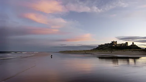
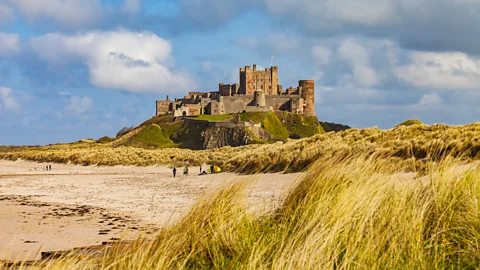
I walked through the shadow of Bamburgh Castle, a mighty edifice of red sandstone that rises from a craggy black rock and has stood sentinel over this coastline for 1,400 years. It’s a long enough time for history to mingle with folklore – this is the castle identified as Joyous Gard, the mythical home of Lancelot – but it remains a living place. The hereditary owner, Francis Watson-Armstrong, grew up in the castle and recently converted two of its towers into holiday apartments.
The path wound through undulating sand dunes, covered with brushy grass that bent energetically in the brisk sea breeze. As I walked through this peaceful landscape, I was surprised to come across relics of war: crumbling World War Two pillboxes and guard towers and long rows of anti-tank obstacles – concrete cubes, some of them jammed in the sand at strange angles, never to be used.
As I reached the Lindisfarne National Nature Reserve, land began to merge with sea. The ground, which earlier that day had been submerged by the tide, was a soft mudflat. Seaweed and driftwood crunched underneath my boots, and tangles of bright blue fishing net lay alongside curly piles of sand – the casts of lugworms. Wooden signs warned that digging for these strange creatures of the mud is prohibited.
The sand had the same pinkish hue as the stone of Bamburgh Castle; beyond it, to the right, Holy Island began flickering in and out of sight like a mirage, the shifting tide causing tricks of light on the horizon.
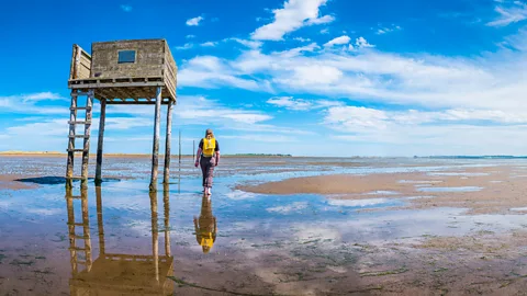
Eventually the island took bolder form as I approached the causeway that connects it to the mainland at low tide. Signs showed photographs of cars up to their wing mirrors in water, swallowed by the onrushing tide, with the warning: “This could be you. Please consult tide tables.” To the right of the car road was the parallel three-mile footpath, known as the Pilgrim’s Way, which I now followed, boots splashing in the wet sand. To either side, notions of perspective and direction disappeared; the route ahead was marked by towering wooden poles that have guided pilgrims to the island on foot for centuries.
 Getty Images
Holy Island, also called Lindisfarne, has been known as a sacred place since the 7th Century CE, when a succession of Celtic Christian monks made their home here. First came Saint Aidan, originally from Ireland, who arrived in 635 CE and established a monastery. He was followed by Saint Cuthbert, who gained popularity as a pious hermit and became known as the patron saint of Northumbria after his death in 687.
“Cuthbert was made Bishop of Lindisfarne, but he gave it up – he was more of a hermit,” explained Phil Bradley, area countryside officer at Northumberland County Council, who joined Schultz and me for a walk around the island.
Holy Island wasn’t quite remote enough for Cuthbert, who would retreat to the tiny Hobthrush Island just offshore, when the monks of Lindisfarne Priory began to annoy him. “There wasn’t much to do here – the monks raised sheep, made mead and created the Lindisfarne Gospels,” said Bradley.
The monks finally saw some excitement – of an unwanted kind – in 793 when marauding Vikings raided the island, killing or enslaving many of the residents and kickstarting the period of Norse conquest known as the Viking Age.
 Getty Images
The monks are gone now, the priory an atmospheric ruin and the Lindisfarne Gospels – masterpieces in the illuminated manuscript tradition – live in the British Library in London. In other ways, though, things haven’t changed much on Holy Island. You can pay a visit to St Aidan’s Winery, as I did, to sample the sweet, rich selection of mead that is still produced here. The sheep are still here, too, outnumbering the human population (which stands at 180) and spending their days in staring contests with the grey and harbour seals that lollop on the island’s rocks.
“The seals make a right racket,” Bradley said. “They howl like wolves.”
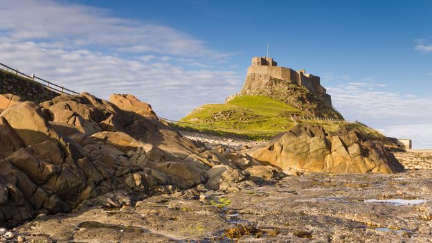
Tourism is a mainstay of the local economy. There are two pubs on Holy Island and several places to stay. In addition to the ruins of Lindisfarne Priory and their adjacent museum, visitors can explore the photogenic Lindisfarne Castle, which was built in the 16th Century as a defence against the Scots and looms over the island’s southern coast.
Fishing is another mainstay of local life. We walked through the harbour, where lobster pots were piled high against low-slung fishermen’s huts, and the masts and sail fittings of boats with names like Moody, Sea Witch and Artful Owl clinked in the breeze. The opening of the coast path, Schultz said, will bring benefits to communities like this nationwide.
“New National Trails are a boost for tourism, of course, but also for local craftspeople and contractors – those who make the signs and the boardwalks, for example,” she said. “They also enhance the landscape. These projects mean increased monitoring of species and biodiversity, and the surfacing and signposting help protect delicate habitats.
 Getty Images
“Most of all, though, it’s about getting people out there – enabling as many people as possible to enjoy walking and being immersed in the natural world.”
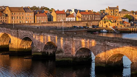
I said goodbye to Schultz and Bradley and headed north from the Holy Island causeway. Streaks of black rock began to stain the sand, as if flicked by a fountain pen. As often happens when one finds oneself alone in the natural world, the environment started to assume personality and agency. The tide was in now, and the surging waves sounded like galloping horses; dark driftwood transformed into animal shapes, shadow dogs and bears sleeping on the sand. Seagulls laughed at me. In this slightly unsettled frame of mind, I was pleased to reach civilisation in the form of the outskirts of Berwick-upon-Tweed, the most northerly town in England.
Berwick has a split personality – it has been described as Europe’s most fought-over town, having changed hands 13 times between England and Scotland, and it’s still a place where national borders blur. The locals speak with a noticeable Scottish burr and many of the younger residents go to school in the Scottish town of Eyemouth, eight miles to the north. The local football team, Berwick Rangers, are the only English club to play in a Scottish league.
The final stretch of the path took me along the cliffs to Marshall Meadows Bay, the northernmost point of England, where a metal sign emblazoned with the Scottish flag marks the national border. My walk on the King Charles III England Coast Path had come to an end – there was no more of England left – but work continues apace on the project, laying this epic coastline open to exploration by more adventurers than ever before.
Slowcomotion is a BBC Travel series that celebrates slow, self-propelled travel and invites readers to get outside and reconnect with the world in a safe and sustainable way.
For the best of BBC.com in your inbox every Friday, sign up to The Essential List newsletter for a handpicked selection of features, videos and can’t-miss news.


